UN
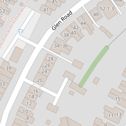
6 Glen Road
£ 154,950
Description
We don't have a Description for this property.
- Bedrooms
- 2
- Bathrooms
- 0

Leaflet © OpenStreetMap contributors
The heatmap indicates the level of crime in the area. The color of the heatmap indicates the crime severity and recency.
Metrics Year-on-Year
- Average area value
- 232,143.00 £Decreased by 14.25 %
- Average area rental value
- 1,581.00 £/moIncreased by 2.13 %
- Est rental Yield
- 8.17 %Increased by 19.10 %
- Crime Rate
- 11.00 %Unchanged by 0.00 %
from 270,720.00 £
from 1,548.00 £/mo
from 6.86 %
from 11.00 %
Nearby Schools
| Name | Type | Ofsted | Distance |
|---|---|---|---|
| Woolston Infant School | Academy Converter | 0.78 KM | |
| Woolston Sure Start Children Centre | Children's Centre | 0.97 KM | |
| St Patrick'S Catholic Primary School | Voluntary Aided School | Good | 1.06 KM |
| Ludlow Infant Academy | Academy Converter | Good | 1.37 KM |
| Ludlow Junior School | Academy Converter | Good | 1.53 KM |
Images
Nearby Streets
| Name | Average Price | Average Sqft | Distance |
|---|---|---|---|
| Foundry Court | £ 0 | 0 | 0.00 KM |
| Portsmouth Road | £ 0 | 0 | 0.00 KM |
| Canute Road | £ 95,000 | 0 | 0.00 KM |
| Enfield Grove | £ 150,000 | 0 | 0.00 KM |
| Sea Road | £ 0 | 0 | 0.00 KM |
Nearby Transport
| Name | NLC | TLC | Distance |
|---|---|---|---|
| Woolston | 5925 | WLS | 0.83 KM |
| Sholing | 5930 | SHO | 1.82 KM |
| Bitterne | 5945 | BTE | 2.90 KM |
| St Denys | 5914 | SDN | 3.40 KM |
| Southampton Central | 5932 | SOU | 4.00 KM |
Nearby Listings
| Address | Price | Type | Score | Distance |
|---|---|---|---|---|
| Woolston | £ 265,000 | BUY | 6 / 10 | 0.07 KM |
| Church Road, Woolston | £ 270,000 | BUY | Unknown | 0.12 KM |
| Swift Road, Woolston | £ 180,000 | BUY | Unknown | 0.12 KM |
| Swift Road, Southampton | £ 290,000 | BUY | 6 / 10 | 0.14 KM |
| Joiners Mews, Southampton, Hampshire, SO19 | £ 270,000 | BUY | 6 / 10 | 0.15 KM |
Nearby Properties
| Address | Price | Distance |
|---|---|---|
| 22 Glen Road | £ 100,000 | 0.00 KM |
| 6 Glen Road | £ 154,950 | 0.00 KM |
| 60a Glen Road | £ 137,500 | 0.00 KM |
| 42 Glen Road | £ 215,000 | 0.00 KM |
| 40 Glen Road | £ 165,000 | 0.00 KM |